About
History & Mission
Staff & Board
Annual Reports
Birding
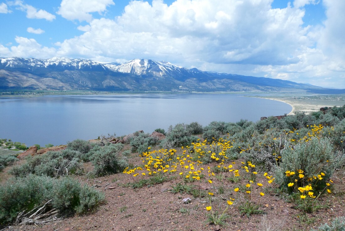
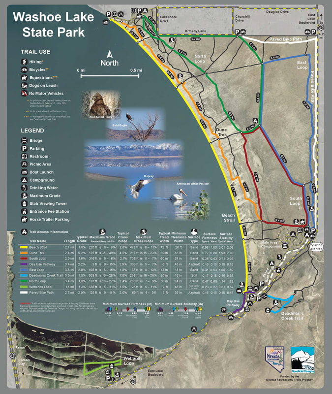
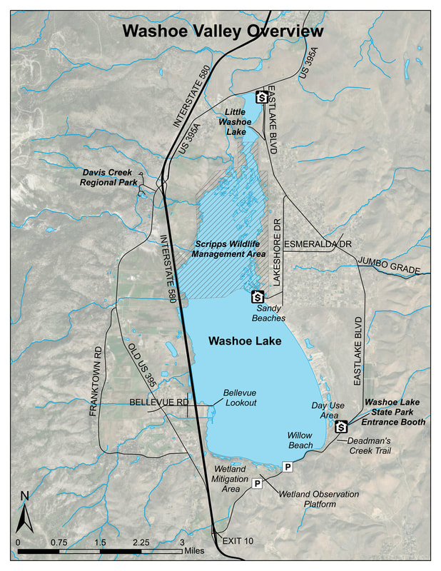
Area Birding Guide
CONSERVATION
Plants for Birds
Birding By Bus
Birding News
GET INVOLVED
Join/Renew
Donate
Volunteer
Calendar
Education
Resources
FAQ
Bird Safety & Ethics
INJURED BIRD? OR BABY BIRD OUT OF NEST?
Urban Waterfowl
Store
CONTACT US
About
History & Mission
Staff & Board
Annual Reports
Birding
Area Birding Guide
CONSERVATION
Plants for Birds
Birding By Bus
Birding News
GET INVOLVED
Join/Renew
Donate
Volunteer
Calendar
Education
Resources
FAQ
Bird Safety & Ethics
INJURED BIRD? OR BABY BIRD OUT OF NEST?
Urban Waterfowl
Store
CONTACT US